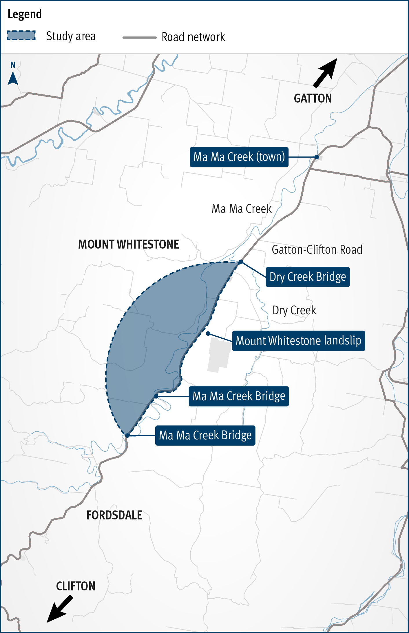
Gatton–Clifton Road Realignment Planning, Mount Whitestone
This planning project aims to identify a new permanent alignment for Gatton–Clifton Road to bypass a 400m section that is affected and at-risk from a large and slow-moving landslip at Mount Whitestone.
Gatton–Clifton Road serves as a important link between the Warrego, New England and Cunningham highways, connecting primary producers and communities in the Lockyer Valley and Darling Downs.
Mount Whitestone is moving laterally at an average rate of 1mm per day, causing tension cracks, subsidence and land surface deformation that is affecting Gatton–Clifton Road.
Extensive monitoring and geotechnical investigations have been conducted since 2010 to understand the impact on the road, and temporary measures have been implemented to maintain road user safety.
Benefits
- Improves safety
- Better road access
- Reduces maintenance
Key features
- Develop a plan to maintain transport connectivity in the event of a slope failure at Mount Whitestone.
- Address community concerns about long-term connectivity and accessibility for local and regional traffic.
- Complete investigations and develop a preferred option ahead of a need for design and construction.
- Ensure the ongoing viability and efficiency of the network link.
Funding
The business case for this project is fully funded by the Queensland Government through the Transport System Planning Program. Investment ID 2632962
- Total investment
- $880,000
- Queensland Government
- $880,000
Current status
The project is seeking input from the local community regarding the landscape and history of Mount Whitestone and Ma Ma Creek, as well as the proposed realignment of Gatton–Clifton Road between Dry Creek Bridge and Ma Ma Creek Bridge.
Community consultation will inform the business case.
Project map